Island Woods Connectivity & Parking for Eagle Residents
October 23, 2025
October 23, 2025
Love the idea of riverfront living but wonder how easy it is to get around from Island Woods? You want short drives for errands, smooth options for work commutes, and access to the Greenbelt for fresh-air miles. This guide lays out your everyday routes, typical travel times, public transit and on-demand options, plus practical tips to plan your days with confidence. Let’s dive in.
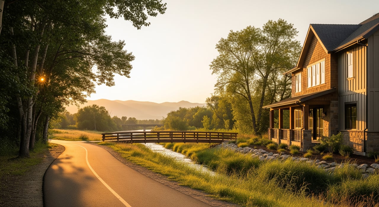
Island Woods is part of the Two Rivers and Banbury area on Eagle’s river corridor. The neighborhood is known for water features, walking paths, and a pedestrian bridge that links directly to river trails. You are a few minutes from downtown Eagle, golf at Banbury Meadows, and Eagle Island State Park, all within a quick local drive. For a feel of the neighborhood character and amenities, explore the Island Woods overview on LivingEAGLE.
Your main east–west route is State Highway 44, also called State Street or Chinden. It connects Eagle to Garden City and Boise to the east and Star and Middleton to the west. Learn more about this corridor on the Idaho State Highway 44 summary.
For north–south travel, Eagle Road, which is State Highway 55, carries most local and regional traffic through the valley. Review the corridor context on the Idaho State Highway 55 page.
For longer trips, you will use connections to Interstate 84, the Treasure Valley’s main freeway. See the regional overview on Interstate 84 in Idaho.
Times vary with traffic and route. Use these ranges as a planning guide, then confirm with live mapping during your usual travel hours.
For day-to-day errands, expect quick local drives. For work commutes into Boise or Meridian, leaving a few minutes early can help you avoid peak congestion on Eagle Road and SH‑44. For longer freeway trips, build in buffer time to reach I‑84.
Fixed-route bus service in Eagle is limited compared with Boise’s core corridors. Valley Regional Transit operates 160 Eagle On‑Demand, a curb-to-curb service you book by app or phone that connects you to transfer points and fixed routes. Check current hours and booking details in VRT’s service change archive and route materials.
Tips for using on-demand service:
If you commute 10 miles or more, consider Ada County Highway District’s Commuteride program. Multi-employer vanpools and ride matching can cut commute costs and stress, and many riders use pre-tax commuter benefits where available. Get a feel for the program’s role in the region in this overview from the Idaho Business Review.
The Boise River Greenbelt runs through the Eagle corridor and links parks and neighborhoods on a continuous paved path. From Island Woods, you can access the trail network by the pedestrian bridge for walking, running, or biking. Explore the system’s reach on the Boise River Greenbelt overview. The Greenbelt is excellent for recreation and some bike commutes, though most daily work trips still happen by car.
Regional agencies regularly study and improve high-use roads like SH‑44 and Eagle Road. Projects can adjust signal timing, add medians, or change turn movements to improve safety and traffic flow, so watch agency updates for construction schedules and access changes.
Island Woods sits in a river corridor, so be aware of floodplain mapping and local drainage infrastructure. When buying riverfront or near-water property, review official floodplain data and HOA guidance as part of your due diligence.
Ready to pair Island Woods’ river lifestyle with the right home and a plan for easy everyday travel? Reach out to Georgie Pitron for local guidance that blends neighborhood expertise with concierge-level service.
Stay up to date on the latest real estate trends.


Get assistance in determining current property value, crafting a competitive offer, writing and negotiating a contract, and much more. Contact her today.